
West African Countries and Geography
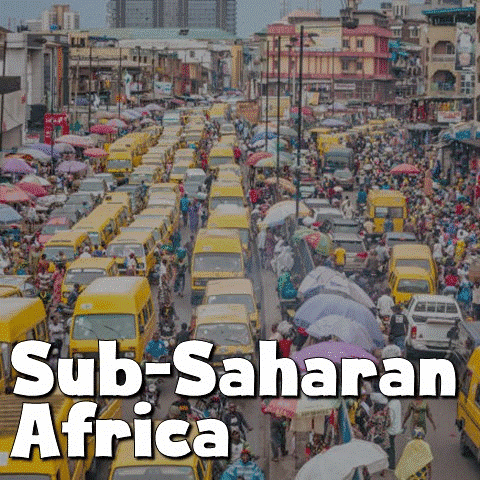
West Africa's geography includes a range of landscapes, from coastal plains and rainforests to deserts and savannahs. This geographical diversity influences various aspects of human life, including settlement patterns, economic activities, and cultural practices.
Benin is found along the Atlantic Ocean's Gulf of Guinea. It includes coastal plains, plateaus, and the Oueme River basin. The country's geographical features influence agriculture, trade, and urbanization patterns. Benin's coastline facilitates maritime trade and fishing industries, while the fertile soils of the Oueme River basin support agriculture. However, the country faces challenges such as coastal erosion and deforestation.
Burkina Faso is a landlocked country, with a flat terrain interrupted by the Volta River and mountain ranges in the west. Burkina Faso's arid climate and limited water resources pose challenges for agriculture and livelihoods, often leading to migration and urbanization. However, initiatives such as soil conservation and irrigation schemes aim to enhance resilience in the face of environmental challenges.
Cape Verde is made up of 10 volcanic islands in the Atlantic. The islands' volcanic landscapes attract tourists, while limited arable land and water scarcity pose challenges for agriculture. Renewable energy sources such as wind and solar power have provided opportunities for sustainable development.
Ivory Coast features a variety of landscapes that include coastal plains, forests, and savannahs. Ivory Coast's coastal plains support agriculture and port cities such as Abidjan, help to facilitate trade and economic growth. However, deforestation and soil erosion have threatened environmental sustainability and economic livelihoods.
The Gambia is the smallest country in continental Africa. It is just a narrow strip of land along the Gambia River, surrounded by Senegal. The country's geography heavily influences agriculture, fishing, and transportation in the region. The Gambia River serves as a transportation route, with rice cultivation along its banks. However, deforestation, climate change, and pollution have had an impact on food security in the country.

Like others in West Africa, Ghana is known for its coastal plains, forests, and savannahs. These features have played a role in its agriculture, mining industry, and urbanization. Ghana's coastal plains support agriculture and fishing, while minerals like gold and diamonds contribute to economy. However, environmental degradation and pollution pose challenges to sustainable growth.
Guinea is a bordered by Guinea-Bissau, Senegal, Mali, Ivory Coast, Liberia, and Sierra Leone, with a coastline along the Atlantic Ocean. The country's geography includes coastal plains, the Fouta Djallon highlands in the interior, and the mountainous southeastern region. The Fouta Djallon region is noted for its plateaus and valleys and is the source of several major West African rivers, including the Niger, Senegal, and Gambia. Guinea's climate varies from a tropical coastal climate to a more temperate climate in the highlands. Rich in natural resources, Guinea has significant bauxite reserves, making it a major global producer.
Guinea-Bissau comprises of coastal plains, mangroves, and rivers, including the Geba and Cacheu rivers. The country's geography plays a major role in agriculture, fishing, and transportation. Guinea-Bissau's riverine terrain support rice cultivation and fishing industries, while the coastline offers opportunities for tourism. However, political instability and environmental degradation have hindered sustainable development.
Liberia features coastal plains, forests, and the Nimba Mountains, which are the southern part of the Guinea Highlands. The country's geography has shaped its agriculture, mining industry, and infrastructure development. Its forests are rich in biodiversity and natural resources, supporting agriculture and mining. However, deforestation and infrastructure deficits hinder economic growth and environmental conservation.
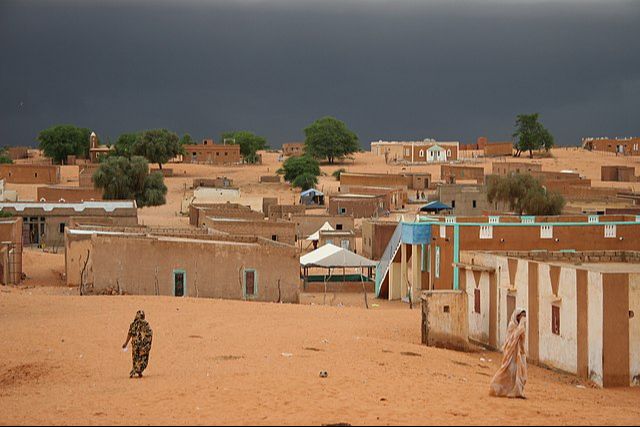
Mali is a landlocked, semi-arid country, with the Sahara Desert in the north and the Niger River basin in the south. It is one of the world's hottest countries, with many areas receiving little rainfall. However, the Niger River creates a large, fertile inland delta as it arcs northeast through Mali from Guinea before turning south into Niger.
Mauritania is known for its desert terrain, including the Sahara Desert and coastal plains along the Atlantic Ocean. The country's geography plays a role in its economy, fishing industry, and transportation. Mauritania's desert landscapes support nomadic herding and mineral extraction, while the coastline offers opportunities for fishing. However, desertification and climate change have affected environmental sustainability and people's livelihoods.
Niger is a landlocked country with the Sahara Desert covering much of it. This has influenced agriculture, nomadic lifestyles, and water resource management in the region. Niger's desert terrain poses challenges for agriculture, leading to migration and urbanization. However, initiatives including drought-resistant crops and water conservation aim to enhance resilience in the face of these environmental challenges.
Nigeria features a variety of geographical landscapes, including coastal plains, forests, and savannahs. These have all played a roll in the country's agriculture, oil industry, and urbanization patterns. Nigeria's coastal plains support agriculture and port cities such as Lagos, facilitate trade and economic growth. However, challenges such as oil pollution and deforestation continue to threaten environmental sustainability and livelihoods of its citizens.
Senegal is characterized by coastal plains, savannahs, and the Sahel region in the north. Senegal's coastal plains support agriculture and fishing, while the Sahel poses challenges for pastoralism with . Initiatives such as reforestation and sustainable agriculture aim to enhance food security caused by the desertification of the Sahel region.
Sierra Leone has four geographical regions. In the east is a plateau is with mountains including Mount Bintumani. The center of the country features lowland plains, forests, and farmland. The north is part of the Guinean forest-savanna ecoregion. The south has rain-forested plains and farmland. In the west is the Atlantic coastline, giving the country bountiful marine resources and tourist potential.
Togo is a tall, thin strip of land with a southern coast along the Gulf of Guinea in the Atlantic. In its north are rolling savannas which turn into larger hills in the center of the country. Despite its small size, there are over 200 small lakes across the country. The coastal region is narrow, with tidal flats and shallow lagoons.